Peter Molyneux, Transport for the North’s Major Roads Director, explains why we need a Major Roads Network for the North and how the network has been mapped out.
We all know that roads are absolutely vital for getting us from A to B. Whether you’re commuting, travelling for business, running errands or making the most of your leisure time, it’s likely that your journey relies on at least a short stretch of the North’s 53,000+ miles of road.
By identifying which of the North’s roads are most important to getting people and goods to their destinations on time, we can prioritise investment on those routes to make them more efficient and reliable. This doesn’t mean that every road we identify will need an upgrade – many of them are doing their job well. But it does mean that we can make the argument to Government for investment in those areas where poor road links holding the economy back.
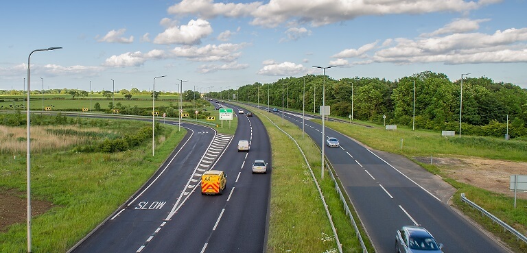 We all know the strategic roads like the M6, M62 or the M1 motorways and major dual carriageways form the backbone of our road network. But only 2% of the roads in the north are strategic routes, managed by Highways England, and it’s often the local roads which determine whether you get somewhere on time.
It’s not just as simple as finding out which roads have the most traffic on them. Some routes which may seem relatively quiet could be the vital link to a port, airport, enterprise zone or university. And it’s also not just about the roads that are most important now.
Transport for the North wants to transform the northern economy to rebalance the whole economy of the UK – this will need economic growth to happen across our region. We will need to improve our links between our economic assets (like ports, factories, research centres, power stations and universities) as well as our fantastic towns and cities. Our Strategic Transport Plan is for the next thirty years and needs to consider the places which will need better connections over that time period.
So how did we decide which are the North’s major roads? Well, we started with the Northern Powerhouse Independent Economic Review (NPIER). Commissioned by Transport for the North, the NPIER represented a unique collaboration with our Partners, the LEPs and central government. As the first pan-Northern economic assessment, it established both the four prime capabilities and the long-term economic projections that quantified the impact of growing the North’s capabilities to help to close the productivity gap between the North and the rest of the UK.
These capabilities are Advanced Manufacturing, Digital, Energy and Health Innovation and the NPIER also mapped locations across the North where they are present – giving us a base map of locations that need to be linked.
We checked this base map with our local partners to ensure it covered all important locations, like major towns and cities, sea ports, airports, enterprise zones, universities and key freight hubs. This also included links to train stations to enable more multi-modal journeys. And then we future proofed the locations by using in local Strategic Economic Plans and Local City Region Strategies to ensure that future growth centres were also reflected.
We then looked at the roads which were vital to connect these locations. We wanted to make sure that all important economic centres were connected to the strategic road network and that, for bigger cities, we had identified all the major routes leading in and out of the city which take the strain at busy times. It was also vital to ensure that we didn’t have cul-de-sacs, locations from which you could only travel in one direction.
The resulting network represents around 7% of the roads in the North, including the strategic road network. It differs from the roads which the central government considers major roads, as it is based on ensuring connectivity not purely on existing traffic flow and it also allows for future growth.
Our Major Road Network map was agreed with all of our nineteen local and combined authority partners last year. It formed the centre of the Major Roads Report, which was published as part of our draft Strategic Transport Plan consultation.
Our Major Roads Network is now informing the recommendations we make about investment in our existing road network. Having a clearly defined and evidenced network has already helped us provide information to the Department for Transport and Highways England about short-term priorities for investment in our road network.
The Government recently carried out a public consultation about the Major Roads Network which they are currently developing for the whole of England. Transport for the North and its partners recommended that the Government should use our well-evidenced network to define the major roads in the North of England. We also joined with other developing Sub-national Transport Bodies (Midlands Connect, England’s Economic Heartland and Transport for the South East) to call for the Government to empower greater local regional influence in defining priorities for road investment. We look forward to seeing the Government’s response to this consultation soon.
Read more about the Major Road Network and Strategic Road Studies.